There is a saying among the people of Auckland that Mount Roskill and Sandringham, suburbs located to the South of Auckland City Centre, constantly vie with each other to be called, ‘Little India.’
While Mt Roskill became the favoured destination for migrants from India after World War II and for Fijians since the first coup in Fiji in 1987, Sandringham began to compete for that status in the late 1970s. Both are somewhat losing their ‘grip’ over Indians with the development of Dannemora and Flatbush in East Auckland since these new areas offer modern houses amidst greener environment.
However, Mt Roskill and Sandringham have continued to thrive as vibrant business centres for and of the business community, the latter concentrating on mini supermarkets, restaurants and takeaways. Mt Roskill offers variety – with shops retailing almost everything that a household needs.
Stoddard Road is considered to be the heart of Mt Roskill and until recently, it was the uncrowned king of the Indian business community. Almost all businesses were owned and operated by people of Indian origin.
Increasing sophistication
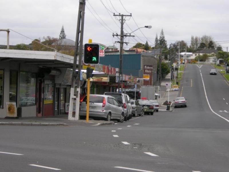 But the area is witnessing significant changes – little shops have become larger, the predominantly Indian food market is today rivalled by larger and mainstream supermarket chains (New World for instance- an exclusive story appears in this Special Report) and computer, home entertainment and electronic dealers.
The opening of Mt Roskill Medical Centre (located at 20 Stoddard Road), operated by East Tamaki Healthcare (see separate story in this section) on July 19, 2013 with a pharmacy attached, has enhanced the services sector in the area.
Council Plans
The following are extracts from the documents posted on the websites of the erstwhile Auckland City Council and the existing Auckland Council.
Innovative youth programmes, Manukau Harbour foreshore enhancements, mixed-use development around Stoddard and May Roads, and an upgrade of the Mt Roskill/Dominion Road Town Centre were among the local priorities discussed at public meetings held two years ago.
These meetings considered a new local blueprint for Puketapapa.
The Auckland Council is also discussing a long-term plan, which includes the ‘Puketapapa Greenways Project,’ to connect local parks and open spaces into ecological corridors for travel across Puketapapa by cycle and on foot.
The initiatives form a part of a draft local board plan prepared by Puketapapa Local Board, which set out the aspirations and priorities of local communities and guide decisions taken by the Local Board to develop the area over the next three years.
A summary of the draft plan, with a submission form was posted to every home in early July 2011. Residents of the area were invited to public meetings to discuss with Local Board members about the priorities and key projects identified for the area.
Puketapapa Local Board Chair Richard Barter said that the ground-breaking plan will shape the future of the local community.
Enhanced Town Centre
“From supporting youth and migrants and driving local events that showcase our cultural identity to revitalising our Town Centres and promoting transport improvements such as the Avondale-Southdown rail link, this Plan reflects the priorities of the people of Puketapapa as we build a strong, safe and prosperous community,” he said.
Local Board Plans, prepared by each of Auckland’s 21 Local Boards, were considered along with the Auckland Plan and Long Term Plan 2012-22.
“The new co-governance arrangements in Auckland give residents an opportunity to play a significant role in decision making alongside elected representatives. The Puketapapa Local Board is no exception. Its members are passionate about Mt Roskill (Puketapapa), its people, open spaces, organisations, schools, businesses and future. The Draft Local Board Plan is based on input made by locals. The Board sought feedback to ensure priorities for the development of the area to reflect their hopes and aspirations,” Mr Barter said.
The Puketapapa Local Board borders the Manukau Harbour and includes the suburbs of Three Kings, Hillsborough, Waikowhai, Lynfield and Wesley.
New Train Station
About three years ago, prior to creation of a single Council amalgamating eight city councils, the Auckland City Council Transport Committee discussed the possibilities of building a new train station at the junction of Stoddard Road and Richardson Road, as a part of the Western Ring Route.
A Council Officers’ Report said that officers were working with New Zealand Transport Agency (NZTA) as the design continued to develop and become more defined.
The Report identified eight key areas where “mitigation and enhancement are required.”
One of them was listed as providing for a new rail station for Stoddard Town Centre at Richardson Road, ensuring quality access between the Station and the surrounding community.
The Report, discussing the location within the Owairaka Town Centre said, “The Council has consistently sought that the interchange and related structures should not detract from or create severance within the Town Centre. This primarily consists of addressing pedestrian and visual features, and ensuring that the future rail station is provided for in an appropriate location.
The Council has sought that the Station be located within the Town Centre, just South of and accessed from Richardson Road, rather than isolated within the interchange. This would give the Council and landowners confidence in the station being an integral part of the Town Centre’s future development.
The Council was keen to ensure that the motorway design and changes to the rail designation do not preclude construction of a quality rail station, accessed from Richardson Road. The interchange works require culverting a portion of an Oakley Creek Tributary behind the industrial properties.
The intention was to partially mitigate this by improving quality of ecology along open sections of Oakley creek elsewhere, such as the Alan Wood Reserve.
Photo : 1. Stoddard Road in 1921 (Picture supplied by Ella Kumar 2. Train station near Stoddard and Richardson Roads junction


